Νομός: Χανίων

Καλικράτης
Kallikratis gorge is situated eastwards from Chora Sfakion in Chania Prefecture, starting from the mountain village of Kalikratis in Sfakia, at an altitude of 750 m (14 km distant from Imbros village), and you need three hours in order to cross it.
The gorge ends in the village of Kapsodasos, at an altitude of 120 m and at a distance of 9 km from Chora Sfakion and 5km far from Fragokastello and after 3,5 hours of walking.
Μέρη κοντινά με Καλικράτης
Asfendou plateau is about 63 kilometres from Chania, at an altitude of 770 metres, and is part of the area known as Sfakia in southwest Crete. It is surrounded by the White Mountains (Lefka Ori).
The road goes through a desolate landscape of steep mountains, small rocky hills, and small fields full of stones. The first village driving from Imbros (west) you will encounter are Asfendou village and plateau. The area is almost entirely deserted, but the stone houses still hold, probably because they are maintained by the shepherds who continue to bring their flocks in the area. The Sfakian village of Asfendou is located in this small and fertile plateau, 8 km from Imbros and 7km from Kalikratis village to east.It has approximately 40 houses and it is inhabited mainly during the summer. In the south of the village, in a small cave, frescoes on the rock have been brought to light, depicting hunting scenes and wild animals. From here through the beautiful ravine (gorge) of Asfendou the visitor can reach the Sfakian village of Vouvas within a 2 hours walk.
Το σπήλαιο "Ασφένδου" βρίσκεται στη θέση "Σκορδολάκια", στο βορειοανατολικό τμήμα της απαρχής του φαραγγιού του Ασφένδου.
Πρόκειται για βραχοσκεπή στο ασβεστολιθικό δάπεδο της οποίας, κοντά στην είσοδο, υπάρχουν βραχογραφίες που παριστάνουν εικονιστικά θέματα (χαράγματα ζώων - θηραμάτων, παράσταση τόξου με βέλος, δέντρου, πλοίου, καμάκι, χιαστί ακόντια ή κουπιά) και αφηρημένα σύμβολα. Η θεματολογία και ο τρόπος εγχάραξης έχουν οδηγήσει ερευνητές να τα χρονολογήσουν στην προϊστορική περίοδο.
Four kilometres of cobbled path dropping steeply in places down an open gorge. I often wonder who built these ancient cobbled ways which still provide excellent walking routes through this rocky landscape.
Follow the path that leads south away from the village down the valley.
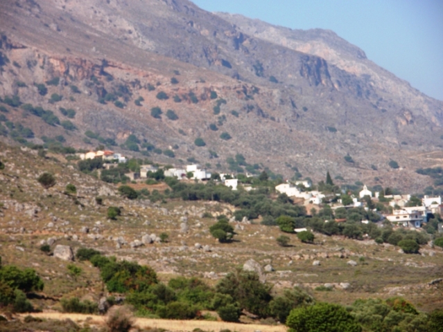
Kallikrates has become a well known name in Greece, being the name given to the government scheme to overhaul local Municipalities, but in Crete it is also the name of a small Plateau and mountain village in Sfakia (west Lefka Ori mountains) where just three Sfakian families remain (2011).The village of Kallikratis was the birthplace of the family of Cretan artist Kostas Mountakis. Located at an altitude of 540 meters, the village and was named by Manoussos Kallikrates, who in 1453, with 1500 men and five ships, led a campaign to defend the area from the Ottomans Kallikrates is accessible either through the village of Asfendou from the west, Asi Gonia from the east or from the windy road which starts north of the village of "Kapsodasos" and ends in the plateau of Kallikrates. Southwest of the plateau is Kallikratis Gorge, which leads to the village of Patsianos. The gorge is 4 km in length.
Walking the Kallikratis - Argiroupoli E4 path.Route - Natural environment: The route is the continuation of the E4 northern branch, coming from the administrative region of Chania. After Kallikratis plateau, the path goes down to Asi Gonia, crosses Giparis gorge and ends up at the water springs of Agia Dinami and the village of Argiroupoli.
The prevailing rocks of the region are limestone rocks with firestones, while there are also: A Phyllitic - Quartzose texture (with schist, phyllites, quartzites, meta-basaltic and meta-gabbro rocks) ñ Colluvial deposits containing mainly limestone ñ Breccia and porous dolomites.
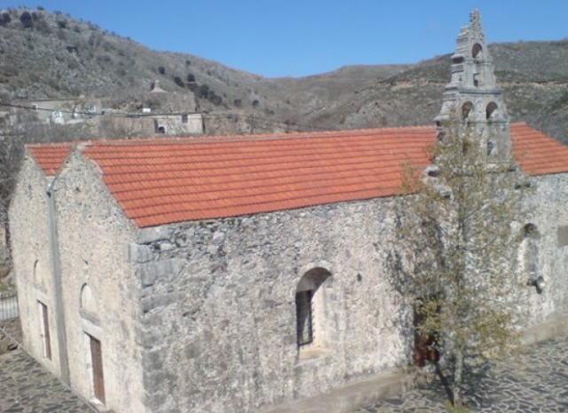
Kallikratis is a stockbreeding village with a great amount of water and vegetation surrounding it. The church of Agios Georgios, the patron saint of flocks, is very interesting.History
Kallikratis has a long tradition of participation in liberation struggles. During the Cretan revolution of 1867, Turkish forces under the command of Omer Pasha tried unsuccessfully to invade Sfakia via Kallikratis. During the German Occupation, Resistance forces had installed a radio in the Anemospilios cave near Kallikrates. The partisan George Psychoundakis in his book, "Cretan runner" states that he had remained hidden in the cave in the spring of 1942, aided by locals. In 1943, the paramilitary group of Fritz Schubert (a branch of the German Wehrmacht) looted and burned the village and executed more than 30 people in retaliation for the participation of local people in resistance against the Nazis. Now that "Kallikratis" is the new benchmark of local government reform, the Sfakian Kallikratis remains a proud corner of Crete.
Before reaching the peak, the road continues to the village of Asfendou, built on a small and evergreen plain, at an altitude of 770 meters, 8 km. from Imbros. It has 40 houses and during summer only a few farmers make their way up here.
East of the village, in a small cave, many beautiful frescoes have been discovered. If you continue to the east for 6 km you reach the village of Kallikratis. In Asfendou you can also visit the Falaggari cave, which is very deep and contains a water basin.You can walk down the Asfendou gorge towards Agios Giorgos/ Agios Nektarios, but this is a quit difficult walk.
Ask for information locally first! The gorge itself will take you about 90 minutes, from 770 meters to 180 meters, so very steep.
Άγιος Νεκτάριος. Είναι μικρό χωριό στο δρόμο προς το Φραγκοκάστελλο, οι κάτοικοι του μετοίκησαν από το χωριό Κολοκάσια(αφού πρώτα το είχαν μετονόμασει σε Άγιο Γεώργιο).


