Your Position:
Unknown
Λεπτομέρειες ΕικόναςImage details
More Photos
Press here.
Glyka Nera
Prefecture: Chania
, Suggest
, Suggest
Your Opinion

If you want to tell us your opinion about this place, please leave a comment
Post a Comment:
Glyka Nera
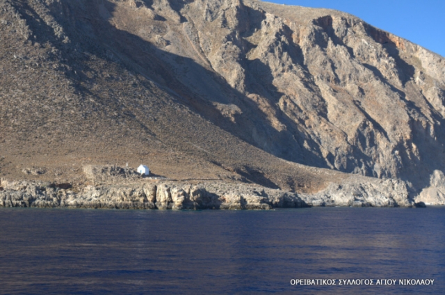
Glyka or Glika Nera beach (Sweet Water) is one of the loveliest beaches in Crete, with no umbrellas or other facilities but with clear blue-green waters in which to cool off after the hot sun.
The sea here is quite cold, due to the icy mountain water that rises in the sea and the sand.
The beach is located between Loutro village and Chora Sfakion.
This water is clean and perfectly drinkable. On the beach you’ll find a small canteen serving refreshments and fast food. Unfortunately there is no shade anywhere on the beach, but you can rent an umbrella from the canteen.
Avoid sitting too close to the cliff because of the risk of rockfalls. Finally, be aware that the beach is popular with nudists, so if you object to the practice you had better avoid the spot.
Access from Chania is possible by public bus and rented or private car and motorbike till Chora SfakionAccess from Loutro, on foot (50 minutes), or by private boat.
Places near Glyka Nera
Ilinga or Iliga or Kavis gorge in Sfakia
The gorge Ilinga - Iliga or Kavis is located between Hora Sfakion and Anopolis village. Lush, beautiful and easy. From Anopolis village, Sfakia, you start to walk 2 hours to the Byzantine church of the Holy Cross (this piece may be performed in rural or Jeep). From here begins the descent, lasting about three hours, leading to the beautiful beach Iligka, 1km west of Sfakia.
The gorge of Ilingas is, surprisingly very beautiful and totally unknown. After heavy rains in winter 2000 is now difficult to walk. From its northern end (Anopolis area) it is possible to get to interesting and abandoned villages, high above Anopolis.
At a distance of 74 kilometers from Chania at the South, and 2 kilometers far from Chora Sfakion at the West, Ilingas beach is a beautiful pebbly beach with very clear water and a large cave, which may give you some shade, as no other natural shade is available.
The beach is not very organized, but in recent years you can find some amenities, like sun beds and parasols, and also a small tavern by the beach that also serves cold water, refreshments and coffee.
One of the great advantages of Ilingas beach is that it’s not affected by the seasonal winds of Crete and the Aegean Sea, the well known “meltemia”, as they are called in Greek. That means you can swim in Ilingas beach even when the winds are high!
Ilingas beach is easily accessible from Hora Sfakion. The beach is located about 2 kilometres west of the village. If you have a car or motorbike, you can take the road to the beach – the trip is very short, lasting only about 5 minutes – and then walk the last 200 – 300 metres to the beach. If you don’t have a vehicle, you can get to the beach from Hora Sfakion on foot after about 30-40 minutes.
It is located at the exit of the Iligas or Ilingas gorge, at a wild natural scenery. Just after Ilingas beach is the start of the E4 path leading to Glyka Nera beach and on to Loutro. Glyka Nera is one of the most beautiful beaches in Crete.
Keep in mind that Ilingas is one of the beaches in Crete that is also popular with naturists. Generally, most of the best secluded beaches in Crete have a smaller or bigger corner reserved for naturists!
If the visitors wish to stay in Chora Sfakion village all day, they can visit a nice and small beach at the village. You have access to Vrissi beach either by a path of a well built walkway and steps into the deep sea or by steps down to the little Vryssi Beach - or if they wish to soak up the sun, there are sunbeds in cleverly adapted recesses overlooking the sea. Vrisi Beach : Chora Sfakion village beach (pebbles; rented beds & umbrellas, 70 meters behind Hotel Stavris)
The plateau of Anopolis is situated right above Loutro, at an altitude of approximately 600m. It is a fertile plain, cooler than the coastal areas in the summer and is the traditional heartland of the region of Sfakia.
From the plateau of Anopolis one has an exceptional view of the south side of the Lefka Ori. Climbs of the highest peaks of the Lefka Ori, at 2,500 metres, start from here. The view of the mountains is particularly impressive in the spring when they are covered in snow. The area is protected from the north winds and it has very mild weather all winter. This area of the Lefka Ori is also famous for its rare wild flowers that can be seen in the spring.
The only road leading to Anopolis is the 12 km serpentines road from Hora Sfakion. The road was recently reconstracted. You can visit anopoli with a bus as well. The bus departs around 4.00pm from Hora Sfakion and returns from Anopolis at around 6.30am. You can also get a taxi from Hora Sfakion which will take you to Anopolis in 10 minutes.
About 2 km west of Anopolis, the abandoned village of Aradena offers beautiful examples of ancient Cretan architecture. The impressive gorge of Aradena is some 19 km west of Chora Sfakion on the road to Anopolis and Agios Ioannis. It starts from the southern slopes of the White Mountains, north of the abandoned village of Aradena and ends at the Libyan Sea near the beautiful beach of Marmara, a little west of Loutro.
Archaeological site of Anopolis: The archaeological site covers a large area and is surrounded by fortified walls. It includes the foundations of several houses, a large basin and probably the foundations of a big temple. Many walls of 1-3 m of height are preserved. Most of them are built with unprocessed rocks, while others are made with shaped stones. The visible ruins reach to the south until the chapel of Aghia Aikaterini, were one can see a part of the Ottoman fortress.The houses found in the area were either built in clusters forming neighbourhoods, or were isolated farm houses. Also, coffer-like graves from the roman period, have been discovered in the area, while the cemetery of the ancient town is located between the Limnia and Pavliana settlements.From 1987 to 1988, Greek and Canadian archaeologists carried a land surface research, discovering several protominoan locations in the Anopolis area, in altitudes between 600 and 800 m. About 2 km west of Anopolis, the abandoned village of Aradena offers beautiful examples of ancient Cretan architecture.
The only road leading to Anopolis is the 12 km serpentines road from Hora Sfakion. The road was recently reconstracted. You can visit Anopoli with a bus as well.


