



Your Position:
Unknown
Λεπτομέρειες ΕικόναςImage details
More Photos
 Upload your photos for Rousso Haraki and share them with us!
 Press here.


Rousso Haraki
Prefecture: Lassithi
 Address:
, Suggest
 Telephone:
, Suggest


Your Opinion

If you want to tell us your opinion about this place, please leave a comment
Post a Comment:

Rousso Haraki
Rousso Haraki
The cave called Rousso Haraki (means red stone) is at the bottom of a scenery bluff and is used as a stockyard. The cave is located 2.5km east of the village.
It is said that in 1943 40 Italian army men were hidden in the cave as they were chased by the Nazi forces for not joining them after the descend of Italy. But they were arrested by the Germans. Four of them escaped on the way to the village and five who were officers were killed later near Sitia.
Πηγή:
«Πεύκοι “Τόπος και Ιστορία”», Γεωργίου Θ. Καναβάκη (Καναβογιώργη), Έκδοση Κοινότητας Πεύκων, Ιούλιος – Αύγουστος 1994
Places near Rousso Haraki


Church of St George of Samakidis
South-east of the village in a distance of 3,5 kilometres and another so long from the settlement of Analypsis is found the little church of St George which in the past was known as Monastery of Samakidis.
It is built under a cavernal precipice at the point where history reports that there was a hermitage of nuns. Writings regarding the Temple or the monastery have not been found. Probably any writings were disappeared at the long-lasting possession of Turks. Tradition and history report that in 1471 A.D. by the raid of Turks most villages of Sitia province and Abbeys were destroyed. «…»
Πηγή:
«Πεύκοι “Τόπος και Ιστορία”», Γεωργίου Θ. Καναβάκη (Καναβογιώργη), Έκδοση Κοινότητας Πεύκων, Ιούλιος – Αύγουστος 1994


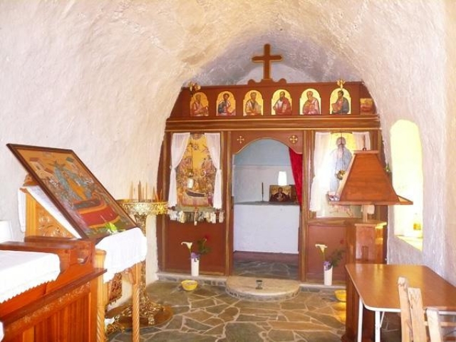
Dormition of the Theotokos church
Two kilometres of East of the village on the way to Lithines the temple of Dormition of the Theotokos (Virgin Mary) is found. History reports it to have been built by Byzantines during the years of their sovereignty (961-1204). Was a monastery dependency of the monastery of ‘Kera’ – Virgin Mary in Pilalimata and it was destroyed from Turks invaders. The temple of Virgin Mary was restored unknown from who and when but it was destroyed once again by Turks from unknown cause. It is said that Turks of Daphne who had their flocks ranging in the area, did not allow the restoration of the Temple. In 1935 again the temple was restored by Mrs Maria Santimpantaki from the village Katsidoni of Sitia and the opening ceremony was held in the same year.
Πηγή:
«Πεύκοι “Τόπος και Ιστορία”», Γεωργίου Θ. Καναβάκη (Καναβογιώργη), Έκδοση Κοινότητας Πεύκων, Ιούλιος – Αύγουστος 1994


Vreiko
The cave of Vreiko is located about 2km north-east of the village. It is a cave and gulch and the known depth is 25-30 metres. The Entrance is an open and flat place that looks like a threshing floor. In the entrance there are stairs that make the entry and exit to the cave easier. A fig tree has grown at that place and its bouches cover a big gallery which is about 60-70 metres long. At the entry and the end of the gallery there are signs from the Neolithic Era.
South of the entrance is the gulch (Latsida) where there is water which dries up during autumn. At this part of the cave there metallic stands to assist people on their ways up and down. In every corner of the cave there are beautiful stalactites and stalagmites.
It is not difficult to visit this cave as cars can go about 250 metres before the caves entrance on the west side and almost on a daily basis, during summer months people visit the cave.
Πηγή:
«Πεύκοι “Τόπος και Ιστορία”», Γεωργίου Θ. Καναβάκη (Καναβογιώργη), Έκδοση Κοινότητας Πεύκων, Ιούλιος – Αύγουστος 1994


 Login with
Facebook
Login with
Facebook