



 Ανεβάστε φωτογραφίες από
Καταφύγιο Καλλέργη και μοιραστείτε τις μαζί μας!
Ανεβάστε φωτογραφίες από
Καταφύγιο Καλλέργη και μοιραστείτε τις μαζί μας!


Νομός: Χανίων
 Διεύθυνση:
Λευκά Όρη
Διεύθυνση:
Λευκά Όρη  Τηλέφωνο:




Καταφύγιο Καλλέργη
Μέρη κοντινά με Καταφύγιο Καλλέργη
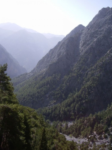

Samaria or the Samaria Gorge is one of the main sights of Crete. Every tourist who visits Crete will have heard of this beautiful gorge or soon will.
Samaria Gorge is found in the White Mountains of south-west Crete in the district of Chania. They are called the White Mountains because the sun shining on the limestone rock of their peaks make them appear that colour.The capital of the district of Chania is the town of that name. It`s a very popular tourist destination on the north coast of the island. If you look at a map of Crete you will find the Samaria gorge directly south of the town but on the opposite coast.The White Mountains contain over forty gorges of various sizes. The best known are Imbros Gorge, The Gorge of Agia Irini and the Samaria Gorge which is definitely the most famous of them all. Even though these gorges are all to be found on the same part of the island of Crete, they all have different characteristics.Samaria Gorge is named after a village of that name which is found about halfway down the gorge. The village in turn gets its name from a small 14th century church sited close by. This is the church of the Holy Mary, in the Greek language, "Osia Maria." So it is easy to see where the name Samaria comes from!The village has been deserted since 1962. The last inhabitants had to leave when the whole area was designated as a National Park. Although many of the old houses still remain, they only act as accommodation for the Park wardens. The old church of Osia Maria is still there, a little way out of the village.All the gorges in the Crete Mountains in Chania were formed by the same geological process. Water ate away the soft limestone rocks over thousands of years after the land had been uplifted by seismic activity. This water erosion has also led to huge numbers of caves being formed. There are as many as 3,000 over the island. A lot of these caves are archaeologically and religiously significant. Over a 100 of the caves have churches in them.The Samaria Gorge starts near the small town of Xyloskalo on a level area in the White Mountains called the Omalos Plateau. The name Xyloskalo can be translated as "wooden stairway." This is because the locals had built just that thing to help them enter down the steep opening into the gorge.The Omalos Plateau is over 1,200 feet above sea level and the gorge runs in a southerly direction from there down to the south coast of Crete near the village of Agia Roumeli.Of all the things to do in Crete visiting the Gorge of Samaria is a must for many tourists, especially those on Crete walking holidays. Mnay Crete excursions are based around this great hike.Coaches will collect you early in the morning and take you to your starting point at Xyloskalo in the Crete mountains. Once you have completed the hike and reached Agia Roumeli on the coast, you catch a ferry boat to the nearby port of Hora Sfakion where your coach will collect you once more.The locals call the gorge "Farangas" which means "great gorge." They also like to claim that it is the longest gorge in Europe, but that is debatable.What is certain is that in some places it can definitely be counted amongst the narrowest!The most dramitic part is a a place known as "Sideroportes" or the "Iron Gates." Here the Samaria gorge is so narrow, being about four metres wide, that you feel as though you can reach out and touch both walls at the same time.If you look up at the cliffs, which rise almost vertically above you for 350 metres, you feel totally overawed!The journey down the gorge, from Xyloskalo to Agia Roumeli on the coast, is about 18 kilometres and although the hike is not an easy one, it is extremly beautiful. The path follows a clear stream which goes through heavily scented pine forests of tall Cypress trees. There are many olive trees and some small fields with low stone walls.The Samaria Gorge is only open to visitors between the beginning of May and the middle of October. There a charge for entering the gorge, at the moment it is 5 Euros. This goes towards the maintenance of the National Park. You must keep your ticket and hand it to the warden as you leave the park, this ensures that no-one is left in the gorge overnight.During the winter months you are unable to go down the gorge.This ban can even occur in the summer season if there has been rain. This is because the pretty stream you cross many times on your hike down the gorge can turn into a raging torrent. Rain or melting snow in the Crete mountains can raise the height of the water considerably.In fact the Village of Agia Roumeli, at the bottom of the gorge, was badly flooded in the 1950`s. There are still some ruined houses which are only now being rebuilt.High winds can also cause problems. Although you may not be aware of them when you are down in the gorge they have been known to cause stones to fall from the 350 metre high cliffs. In fact there are signs warning of this danger.Any walk down the gorge usually becomes a competition to spot the rare Kri-Kri.This is a Cretan Wild Ibex with distinctive curved horns. It was introduced into Samaria gorge as a refuge for it. In fact this is only one of two places it is to be found.If you are very lucky you may spot some rare birds such as the Griffon Vulture, Bonelli`s Eagle and the Golden Eagle.One thing about Samaria Gorge you should be aware of is its popularity. During the tourist season there will be lots of people hiking through it every day.The beauty and dramatic quality of Samaria Gorge make it one of the most popular gorges to visit in the world.


Φαράγγι και σπήλαιο Βρυσί
Το Βρυσι είναι ένα κακοτράχαλο φαράγγι στον τόπο των φαραγγιών και των σπηλαίων.
Η διάβαση του πραγματοποιείται είτε από την Ζούρβα, είτε μέσω του καταφυγίου Καλλέργη, από τον Ομαλό,. Μέσα σ’ αυτό το φαράγγι ευρίσκεται ένα σπήλαιο με υπόγειο ποτάμι, το Βρυσί, από το οποίο έλαβε το όνομα του και το φαράγγι.
Η πρώτη εξερεύνηση επιχειρήθηκε τα έτη 1985 και 1986 από μια αποστολή Ιταλών φοιτητών που προχώρησαν στο υπόγειο ποτάμι ερευνώντας τις δυο γαλαρίες του, μέχρι αποστάσεως 350 περίπου μέτρων από την κάθε είσοδο. Την 15η Σεπτεμβρίου 2001 μια ομάδα από την Σπηλαιολογική Ομάδα Χανίων και από τον Σπηλαιολογικό Όμιλο Κρήτης έφτασαν στα ίδια σημεία όπου και οι Ιταλοί.
Κατά την περιγραφή των μετά από διαδρομή 150 περίπου μέτρων το σπήλαιο διχάζεται και προχωρεί με δύο γαλαρίες που και οι δύο διασχίζονται από μικρό ποτάμι. Υπάρχει θαυμάσιος φυσικός διάκοσμος από σταλακτίτες, ιδίως στα πρώτα διαμερίσματα, και οι συνεχείς μικρές λίμνες- γούρνες, ορισμένες με αρκετή ποσότητα νερού, σε συνδυασμό με το διάκοσμο καθιστούν το χώρο του σπηλαίου φαντασμαγορικό.
Η επίσκεψη του συστήνεται μόνο με συνοδεία οδηγού από τον ορειβατικό όμιλο Χανίων.

On the right hand side of the road descending from the Omalos plateau to Chania, there is the large canyon-cave called Honos or the Cave of Tzanis, which served as the den of the chieftain Tzanis Markos during the first years of the Turkish invasion.
Nicknamed ‘Fovos’ (fear), he struck terror into the hearts of the invaders. The cave was explored for the first time by speleologists from Chania and France. It is 2.5 kms in length, and the height of the cavern is 241 metres; it forms a huge covered gorge.
Opposite the entrance of the cave of Tzanis, on a small knoll, there is the Tower and chapel of the famous rebel chieftain from Lakki and hero of the Lefka Ori, Hadzimihalis Yiannaris (1851-1916). One of the pioneers in the uprisings of 1855 and 1856 and a major contributor to the great uprising of 1866-1869, he was imprisoned many times by the Turks but always managed to escape. On one occasion, about to attempt the almost impossible escape from the fortress of Firkas in Chania in 1860, he vowed that if successful he would build the small chapel of Agios Panteleimon in Omalos next to the Tower. He kept the vow and, honoured as a general, was buried there according to his own wishes, in his old "lair". Great both in stature and soul, he served as a general leader of the district of Kydonia in Chania from 1866 to 1898.
Ένα σηματοδοτημένο ανηφορικό μονοπάτι, που ξεκινά μέσα από το χωριό και διασχίζει το κυπαρισοδασος σας οδηγεί σε υψόμετρο 1000 περίπου μέτρων στο φαράγγι της Τρομαρισας, και συγκεκριμένα στην τοποθεσία Κισσονερο όπου βρίσκονται μια πηγή με κρυστάλλινο νερό, 3 αιωνόβια ,τεράστια σε όγκο και ύψος πλατάνια και ένα παλιό μητάτο.
Δυνατότητα οργάνωσης ημερήσιας εκδρομής με οδηγό βουνού (σε συνεργασία με τουριστικό γραφείο εκδρομών) στο φαράγγι της Τρομάρισας, η το Βρυσι για ομάδες από 4 έως 10 άτομα.
Διάρκεια πεζοπορίας περίπου 5 ώρες.
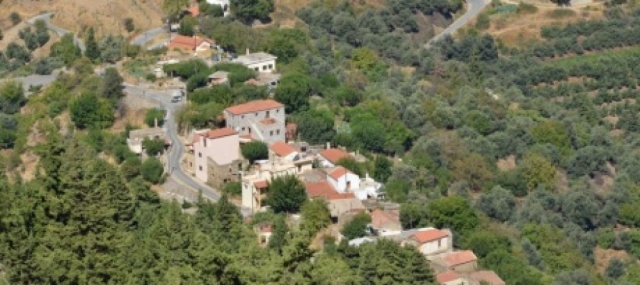

ΤΟ ΧΩΡΙΟ ΖΟΥΡΒΑ
Νότια στην ενδοχώρα του νησιού 24 χιλιόμετρα από την πόλη των Χανίων στο βάθος της γραφικής κοιλάδας του Κεριτή, στις παρυφές της οροσειράς των Λευκών Ορέων, σε υψόμετρο 570μ βρίσκεται η Ζούρβα, ένας μικρός ορεινός οικισμός του δήμου Πλατανιά, στο νομό Χανίων.
Μέσω δύο διαφορετικών διαδρομών -είτε μέσω του πανέμορφου φαραγγιού του ιστορικού Θερίσου είτε μέσω των Μεσκλών με τη μακραίωνη παράδοση- μπορεί να φτάσει κανείς στη Ζούρβα.
ΟΙ ΚΑΤΟΙΚΟΙ
Οι κάτοικοι του χωριού,θεματοφυλακες των παραδοσεων, διατηρούν αναλλοίωτα τα αγνά χαρακτηριστικά της Κρητικής φιλοξενίας και κουλτούρας.
ΔΡΟΜΟΣ
Ο δρόμος ασφαλτοστρωμένος μα ανηφορικός, οδηγεί στις παρυφές της οροσειράς των Λευκών Ορέων, στους πρόποδες του όρους Kαλόρος. Το κυπαρισοδασος που αναπτύσσεται πάνω από τον οικισμό, το φαράγγι της Τρομαρισας και η εκπληκτική θέα προς τον βορρά και την θάλασσα σε συνδυασμό με το μικροκλίμα της περιοχής δημιουργούν αίσθημα εφορίας στον επισκέπτη ανταμείβοντας τον για την επιλογή του.
ΠΕΖΟΠΟΡΙΑ ΚΑΙ ΜΟΝΟΠΑΤΙΑ
Πεζοπορώντας ή και με το αυτοκίνητο η ευρύτερη περιοχή έχει πολλά να δώσει στον επισκέπτη. Μονοπάτια στην καρδιά της φύσης, σπήλαια, υπόγειες πηγές, απομεινάρια αλλοτινών εποχών είναι μερικά από τα στοιχεία που κάνουν τη διαμονή στη Ζούρβα μια αποκάλυψη.
Ο ΧΕΙΜΩΝΑΣ ΣΤΟ ΧΩΡΙΟ
Το χειμώνα το χιόνι δημιουργεί ατμόσφαιρα ονειρική καθώς σκεπάζει τις γύρω βουνοκορφές και αγκαλιάζει το πυκνό πράσινο. Τόπος που αξίζει να εξερευνηθεί με συντροφιά τα λεύτερα πουλιά που φωλιάζουν στα δάση και τη δροσερή πνοή του ανέμου που εξαγνίζει νου και ψυχή.
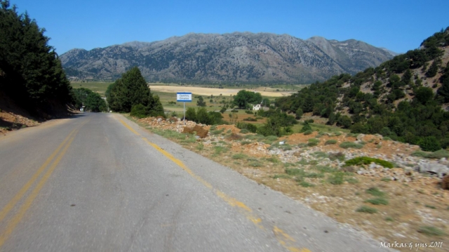

Lakkoi (Greek: Λάκκοι), commonly spelled Lakki on road signs and maps, is a village on the Greek island of Crete in the foothills of the Lefka Ori (White Mountains). The village is situated on the road between Chania and the plateau of Omalos which leads to the Samaria Gorge.
Lakkoi is 450 meters high, below the White Mountains which rise another 1,000 meters to the south. Most of the houses cling to steep slopes covered in olive and chestnut trees, reached through narrow roads or tracks that run down from the main square.The climate is cool in winter, with occasional snow, wet in spring, hot and dry in the summer. In the unusually dry summer of 2007, major brush fires broke out twice, burning about 2,000 acres and threatening the village itself.Traditionally the villagers have cultivated olives and raised goats, sheep and chickens. With limited work opportunities, the population has declined from a peak of around 2,000 to about 400 today. There are signs of growth as houses are being purchased and renovated by citizens of other European Union countries seeking low-cost retirement or vacation homes.The first historical mention of the village dates from 1263, when the Lakkoi chieftain Pentachtenis took part in a revolt against the Venetians. In a later revolt in 1570 the chieftain George Mousouris became Secretary General of the rebel forces, based in the nearby village of Meskla.After the Ottoman conquest of the island, the people of Lakkoi were involved in periodic revolts, notably the revolt of 1821-1828 during the Greek War of Independence, where an Ottoman army of 5,000 men led by Latif Pasha of Chania was routed in a pitched battle at Lakki. In the great rebellion of 1866-1869 Katerina Stamataki of Lakkoi was a distinguished woman revolutionary.During the Battle of Crete in May 1941 and the days that followed, four hundred and eighty five men and women resisted the German occupiers, and sixty eight Lakkoiotes lost their lives in the fight for the freedom of Greece.

Στην κοιλάδα των Νέων Ρουμάτων της Κρήτης, στη θέση «Πεύκος», βρίσκεται ένας σημαντικός πρωτομινωικός τάφος, που έχει άμεση σχέση με τους σύγχρονούς του κυκλαδικούς. Ένας δεύτερος θολωτός τάφος όμοιας κατασκευής, αλλά μικρότερων διαστάσεων, έχει ανασκαφεί σε άλλη θέση στην ίδια περιοχή, ενώ ίχνη πρωτομινωικών εγκαταστάσεων έχουν εντοπισθεί σε διάφορα υψώματα γύρω από την κοιλάδα των Νέων Ρουμάτων.
Ο τάφος είναι μικρών διαστάσεων, θολωτός, κτισμένος με ποταμίσιες πέτρες και περιείχε ένα νεκρό σε συνεσταλμένη στάση και δύο αγγεία ως κτερίσματα. Αποτελεί νέο στοιχείο για την πρωτομινωική ταφική αρχιτεκτονική, καθώς οι μέχρι σήμερα γνωστοί στην Κρήτη τάφοι είναι μεγαλύτερων διαστάσεων, με πιο αντιπροσωπευτικούς τους μεγάλους κυκλικούς της Μεσαράς, όπου φαίνεται ότι θάβονταν τα μέλη ενός ολόκληρου γένους. Σε δοκιμαστική έρευνα που πραγματοποιήθηκε στο χώρο γύρω από τον τάφο βρέθηκαν διάσπαρτες πέτρες και λίγα όστρακα ανάμεσά τους.
Το μνημείο αποκαλύφθηκε τυχαία το 1980.

A small mountainous ancient city, built inside Samaria gorge near the banks of the river. The city developed in the ancient years and according to tradition it was the birthplace of Artemis the Britomartis, called Diktini, who was the daughter of Zeus.
In 1991, they found an outdoor sanctuary near the church of Agios Nikolaos as well as many bronze and iron, arrows and spears. That was probably the oracle of Apollo or else, the Kirikion Andron. It is said that the nymph Akakali, wife of Hermes and daughter of Minos was worshipped there.


 Σύνδεση με
Facebook
Σύνδεση με
Facebook