Press here.
Places near Plakes
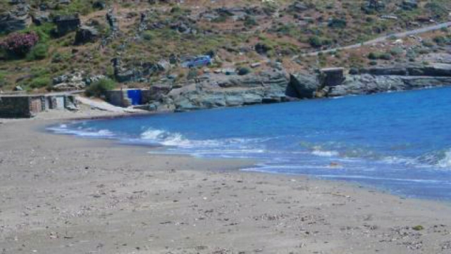
CHALKOLIMIONAS
Location: Right in the center of the west side of the island, in the area of Stavropeda.
Special features: Sandy beach with shallow waters. It is surrounded by rocks and is ideal for fishing. There are sunbeds and a beach bar. From ancient to modern times, there were mines running in the area.
How to get there: Very easily by car. Follow the main road towards Chora and, at Stavropeda, turn right and then right again to get to the beach. There is ample parking space.
ZAGORA
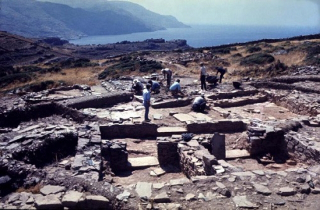
Zagora is one of the best preserved cities of the Geometric period in Greece. Its ancient settlement is located on a remote mountain plain (160 meters altitude) on Zagora peninsula. The excavations that took place from 1960 until nowadays have revealed important finds. Its life began on the 10th century BC and lasted until the end of the 8th century BC. The settlement was protected by a strong wall approximately 100 m. long, 2-4.80 m. wide and 3 meters high. Inside there is a temple that was built in the 8th century BC and was used until the Classical Period, although the settlement had been abandoned 300 years ago. The houses were built of stone and had roofs made of earth (doma). Remains of this settlement can be seen in the Archaeological Museum at Chora, as well as a model replica of a house and a temple.
Location: In Zagora mountain plain, on the west side of the island.
How to get there: On foot, following the relevant path from "Agia Triada" (shortly after Stavropeda) to Korthi. It’s approximately a 40-minutes walk. There are path signs and the route is very interesting.
TROFILAS
This Neolithic settlement had been discovered in the area of Stavropeda, on the west coast of the island. It is the largest settlement of the Final Neolithic period found in the Aegean and extends over an area of about 25000-30000 m2. The settlement was brought to light by the excavations of the 11th Ephorate of Prehistoric and Classical Antiquities. They revealed a wall of 100 m. length, up to 2 m. height and 1.60-2.00 m. width, as well as impressive clay pots, jars, pots, stone tools, arrowheads, jewelry, figurines, bronze objects, etc. The settlement dates back to around 4000 BC and is characterized as the largest and best preserved Neolithic settlement of the Aegean. It was densely built-up with early urban structures, involving proportional social coordination. The carved rock shapes representing animals, fish, etc. are impressive, while the ship representations prove that Cycladites were wandering the seas since then.
Location: At the area of Stavropeda, in the center of the west side of the island, in Strofilas mountain plain.
How to get there: The site is not organised and you can get there only on foot. Follow the road right of Stavropeda and then left, towards the path that leads to the mountain plain.
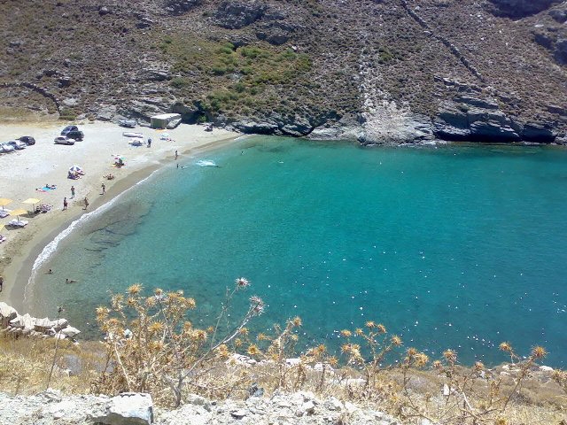
APOTHIKES
Location: Right in the center of the west side of the island, in the area of Stavropeda.
Special features: Sandy beach with crystal clear waters, a small and scenic cove, ideal for fishing. There are few sunshades and a beach bar.
How to get there: By car. Follow the main road towards Chora and, at Stavropeda, turn right and then right again to get to Chalkolimionas beach. Approximately half kilometer before the end of the road, there is a gravel road to your left that leads to Apothikes. There is a parking area.


