



Your Position:
Unknown
Λεπτομέρειες ΕικόναςImage details
More Photos

 Upload your photos for Aloida and share them with us!
 Press here.


Aloida
Prefecture: Lassithi
 Address:
Οροπέδιο Λασιθίου
Address:
Οροπέδιο Λασιθίου  Telephone:
, Suggest


Your Opinion

If you want to tell us your opinion about this place, please leave a comment
Post a Comment:

Aloida
ΑΛΟΙΔΑ
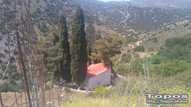
Το καταφύγιο και ορμητήριο των χαϊνηδων της ανατολικής Κρήτης. Εδώ φώλιασε η αντάρτικη ομάδα που ίδρυσε και καθοδηγούσε ο Μανόλης Καζάνης πριν και κταά τη διάρκεια της επανάστστασης του 1821, που μέλος της υπήρξε κοι η θρυλική Ροδάνθη.
Places near Aloida




Katharo is a plateau on the east side of Dikti mountain on the island of Crete, in the prefecture of Lassithi. Administratively it belongs to the municipality of Aghios Nikolaos, (municipal division of Kritsa).
It is 16 km from Kritsa (asphalt road) and 12 km from Mesa Lassithi (rough mountain road). It is 4km long, 1.5km wide and at an average altitude of 1150m above the sea level (300 m higher than Lassithi Plateau).
On the West of the Katharo are the peaks of Spathi (2148m) and Lazaros (2085m) and on the North East and East the peaks of Tsivi (1665m) and Platia Koryfi (1485m). The waters of the Plateau drain through the Havgas gorge into the much larger but lower Plateau of Lassithi, i.e. Katharo is part of river Aposelemis drainage area.Due to its altitude the plateau is not inhabited in winter while in summer it has about 500 inhabitants mainly shepherds and a few tavernas. Katharo has a special property status and is essentially community-owned. The fertile soil of the plateau is used for production of vegetables, potatoes and fruit (grapes, pears, apples).
Katharo Plateau Katharo Plateau Katharo Plateau Katharo Plateau Katharo Plateau Katharo Plateau Katharo Plateau Katharo plateau by lasithi mountains Katharo plateau by lasithi mountains Kritsa village
Hiking with the Mountaineering Club of Agios Nikolaos (http://pezopories.blogspot.com):
See the route in the first image..
The route starts from the Church of the Holy Cross, which is approximately 20 minutes drive to west from the small village square in Katharo plateau with tavernas.
It is 16 km from Kritsa (asphalt road) and 12 km from Mesa Lassithi (rough mountain road). It is 4km long, 1.5km wide and at an average altitude of 1150m above the sea level (300 m higher than Lassithi Plateau).
On the West of the Katharo are the peaks of Spathi (2148m) and Lazaros (2085m) and on the North East and East the peaks of Tsivi (1665m) and Platia Koryfi (1485m). The waters of the Plateau drain through the Havgas gorge into the much larger but lower Plateau of Lassithi, i.e. Katharo is part of river Aposelemis drainage area.Due to its altitude the plateau is not inhabited in winter while in summer it has about 500 inhabitants mainly shepherds and a few tavernas. Katharo has a special property status and is essentially community-owned. The fertile soil of the plateau is used for production of vegetables, potatoes and fruit (grapes, pears, apples).
Katharo Plateau Katharo Plateau Katharo Plateau Katharo Plateau Katharo Plateau Katharo Plateau Katharo Plateau Katharo plateau by lasithi mountains Katharo plateau by lasithi mountains Kritsa village
Hiking with the Mountaineering Club of Agios Nikolaos (http://pezopories.blogspot.com):
See the route in the first image..
The route starts from the Church of the Holy Cross, which is approximately 20 minutes drive to west from the small village square in Katharo plateau with tavernas.





 Login with
Facebook
Login with
Facebook